The river finds the marsh again
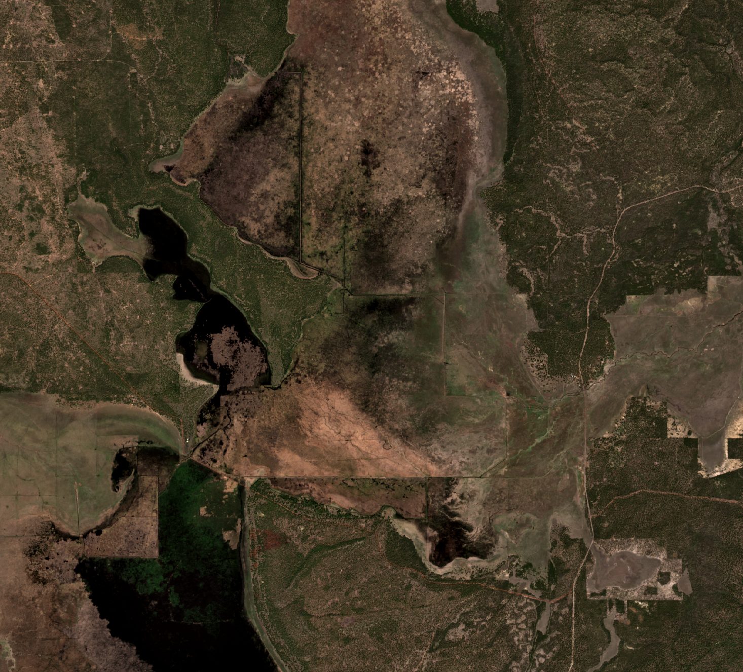
In November 2024 the Klamath Tribes and the U.S. Fish and Wildlife Service breached the YJ canal and let the Williamson River spill back across Klamath Marsh. Satellite imagery from 2022 to 2026 shows where the water went, how far it spread, and what it tells us about the design ahead.
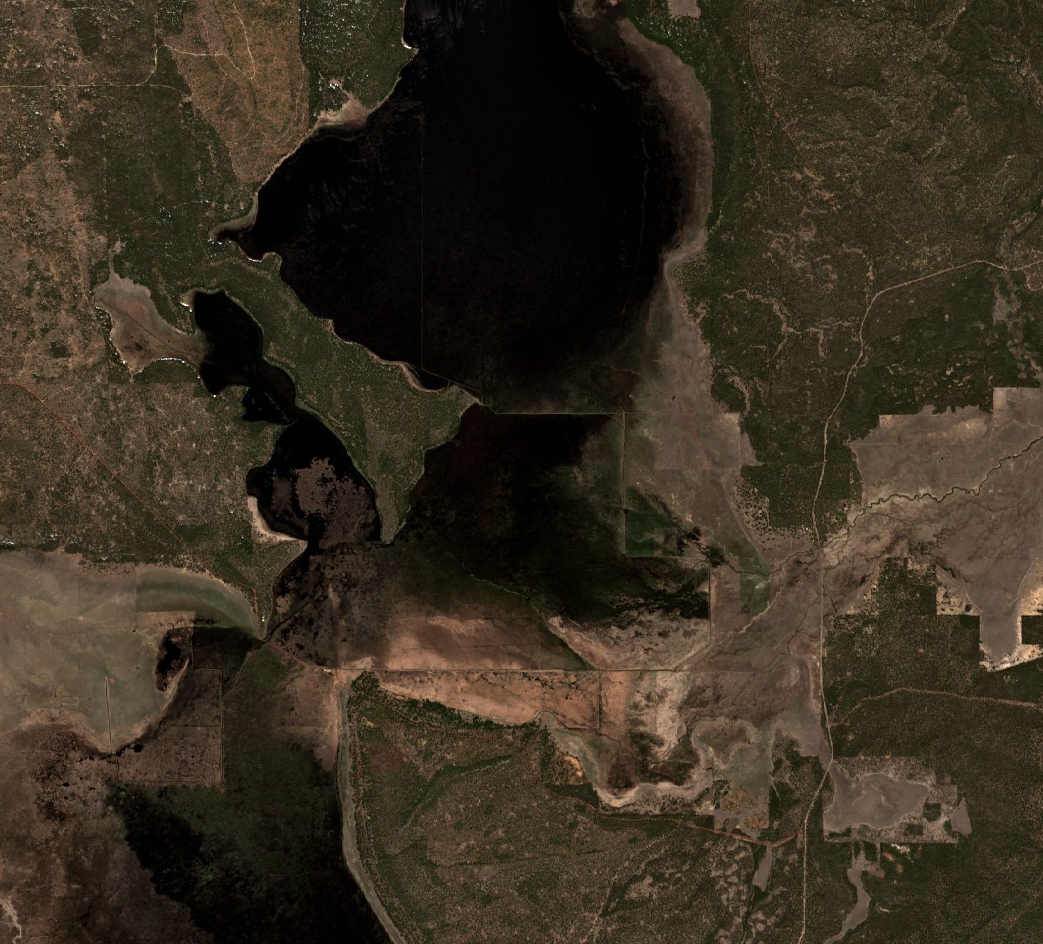
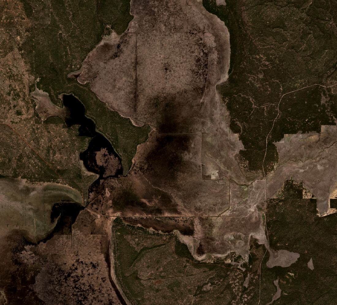
 Apr 18, 2024 before
Apr 21, 2025 after
A river that ends in a canal
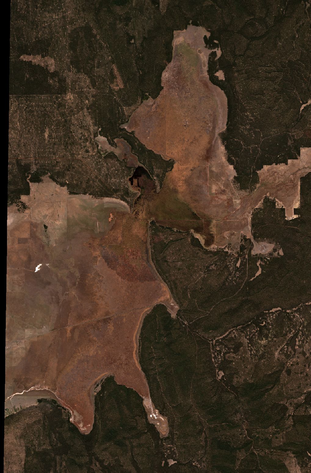
Klamath Marsh National Wildlife Refuge covers about 43,700 acres of emergent marsh and open water roughly 50 miles north of Klamath Falls. For the Klamath Tribes it has long been a home and a pantry: big game, waterfowl, fish, tule, and wocus, the pond-lily seed that gives Wocus Bay its name.
Beginning in the late 1800s, diversions, levees and dams reworked the marsh for irrigation and grazing. Today the Williamson River does not spread out where it reaches the marsh. Between Silver Lake Road and Military Crossing Road it runs into a set of canals, ditches and control structures, chiefly the north–south YJ canal and the east–west Kittredge canal, which carry water around the marsh instead of across it.
Streamflow here is mostly groundwater-fed and varies widely from year to year. Minimum marsh water levels tied to the Tribes' water right, held by the Service, have not been met in recent decades.
Two days at the marsh
The refuge convened a wetland hydrology workshop at Klamath Marsh, about two dozen people in all. Representatives of the Klamath Tribes opened with the marsh's cultural background. Sessions on geology, hydrology, fluvial geomorphology, the history of modifications, and water rights and law followed, with time in the field.
By the end, the group had agreed on a hypothesis: if river water could get past the canal and back onto the marsh surface, it would find its old flow paths. The test was an experimental breach. RES's Dave Coffman led the session that turned the idea into an implementable alternative. Colin Thorne, now advising Wolf Water Resources, was among the participants.
“We came to consensus, crafted a hypothesis, developed a strawman experiment, and implemented it.”
John Vradenburg, Supervisory Biologist, Klamath Basin NWR Complex, February 2025
- Oct 29–30, 2024Klamath Marsh wetland hydrology workshop. The group agrees on a hypothesis and a strawman experiment.
- Nov 12, 2024YJ canal breach finished. River water is routed into the marsh.
- Dec 4 and 9, 2024Snow on the ground shows the water's path; the Tribes fly UAV surveys.
- Feb 27, 2025Snowmelt begins. Water moves west and north through relic channels.
- Spring 2025The project reach peaks near 2,100 wet acres, the most of any image from 2022 to 2026.
- Water year 2026Snow drought. The reach stays mostly dry; the upper marsh holds more water than in the 2022 and 2024 dry years.
- Oct 2026Ducks Unlimited requests H&H and design to route the river through the breach location for good.
Thirteen days later, a breach
The plan changed in the field. Led by Klamath Tribes staff, the team skipped the lower structure, where water could spill over either bank, and moved the diversion north to Rock Island to use existing infrastructure. Water now runs down a short supply channel to the breach area. Tribal staff cleared the way with the Oregon Water Resources Department, completed cultural compliance, and checked grades on site with the crew. The refuge field crew mobilized and did the work. The breach was finished on November 12, less than three weeks after the workshop began.
Monitoring started right away. The refuge set out four water-level loggers to track benefits to the marsh's closed-basin (endorheic) zone, the Tribes flew UAV surveys, and the refuge asked a Forest Service colleague to follow up on modeling now that water was moving across the landscape.
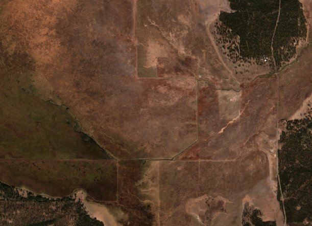
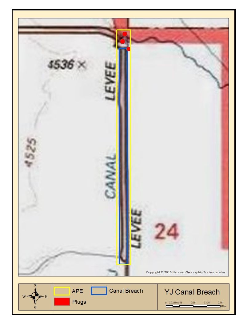
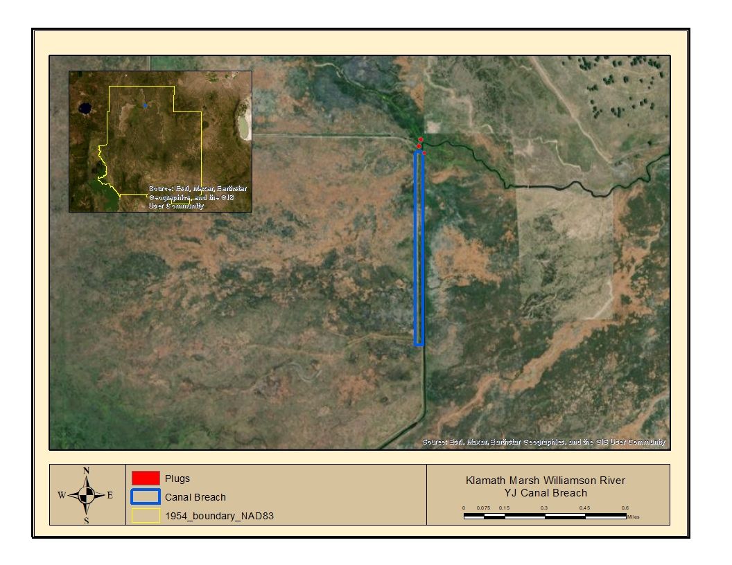
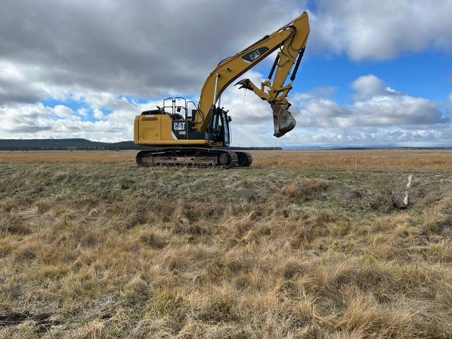
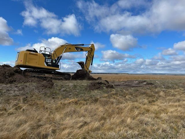
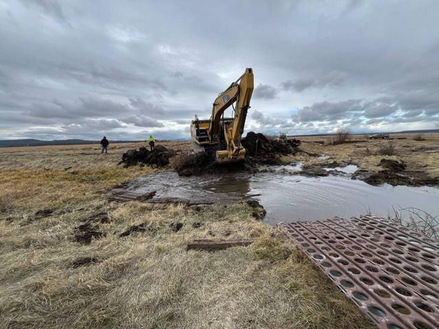
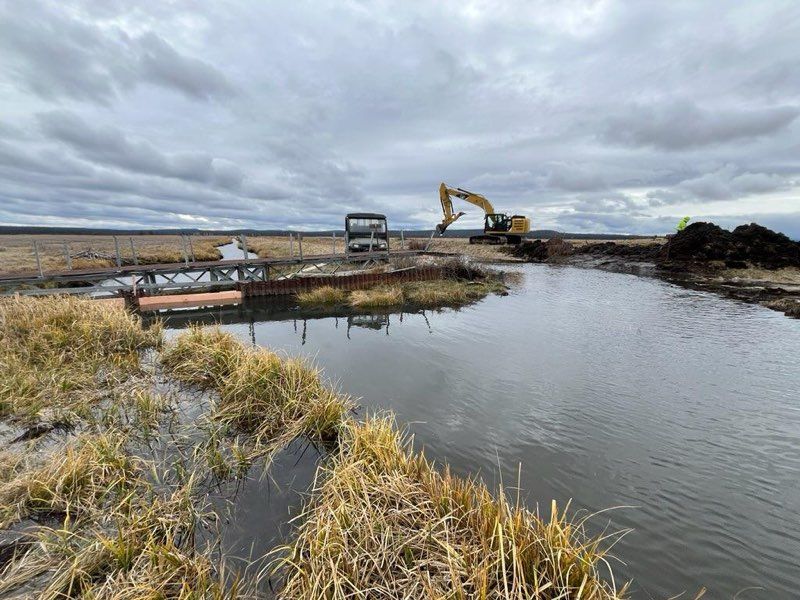
Photos and maps: USFWS Klamath Basin National Wildlife Refuge Complex, shared November 13, 2024.
The water shows its path
These frames use a shortwave-infrared false-color composite, which separates water from snow and dry ground better than true color. Scroll to step through the first winter.
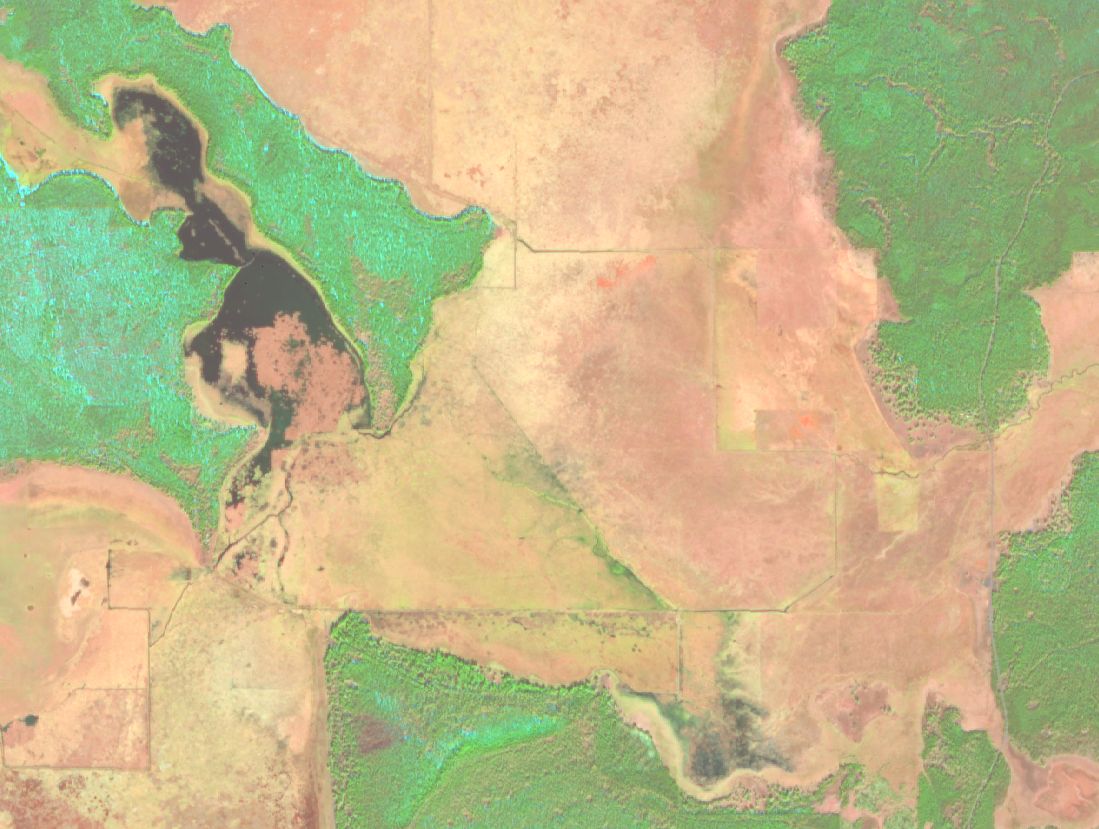
The canal holds the river
Five days before the breach was finished, the marsh west of the YJ canal reads as dry ground. The river's flow stays in the canal system.
A dark tongue in the snow
Snow covers the marsh. West of the breach, water soaking into the snow shows up as a dark band reaching roughly a mile and a half from the canal.
“Snow on the ground is making the water movement really clear.”
J. Vradenburg, Dec 13, 2024
Five days, more ground
The wetted footprint keeps widening to the west and northwest, about two miles from the breach, read from the imagery. Thirty days after construction, the refuge wrote that it could “only imagine how wet things will be by the end of winter.”
Spreading under winter cover
Midwinter. Ponded water and saturated snow, in the darker blue tones, spread over the frozen marsh surface west of the canal.
Back on its old paths
Early snowmelt. The water stayed out of the old ditches and did not run back south to the modified channel. It moved west and north, filling the upper marsh, pushing into the reach between Military Crossing and Silver Lake Road, and moving south into both Wocus bays.
“…moving through relic channels, flowing to low areas, telling us a story it has not been able to tell.”
J. Vradenburg, Feb 28, 2025
Peak in the project reach
2,098 of the reach's 4,360 acres read as wet, the most in any clear image from 2022 to 2026. Some snow lingers on the margins.
The upper marsh fills
Snow is gone. About 6,479 acres of the upper marsh and 1,818 acres of the reach are wet.
Green-up
By mid-June the areas that held water have turned to vigorous growth, the bright green in this view.
Breach effect or a wet year?
2025 was a wet year, so a fair test compares it with another wet year. Water year 2023 had a bigger April snowpack at the nearest SNOTEL stations. Water year 2025 had more precipitation through April 1. With the canal intact in 2023, the project reach peaked at about 400 wet acres in spring. With the breach open in 2025, it peaked near 2,100.
Water year 2026 was a snow drought: April 1 snowpack at Silver Creek was 2% of median. The reach stayed mostly dry that spring. The upper marsh still held 2,200–2,700 acres in March and April, five to six times the 2022 and 2024 springs. Whether that reflects the breach, groundwater carried over from 2025, or both is a question the H&H study is built to answer.
Project reach: spring peak wet area, by year
Highest wet acreage in any clear March–May Sentinel-2 image. Reach = 4,360 acres between Military Crossing Rd and the YJ canal.
Every clear image, 2022–2026
Wet acres per Sentinel-2 image (SWIR-1 reflectance below 0.06). Winters are blank because snow cover prevents a reliable reading. Nov 7, 2024 is omitted for early frost and snow; points appear only where at least 90% of a zone is free of cloud and snow.
Show data table
Where the new water went
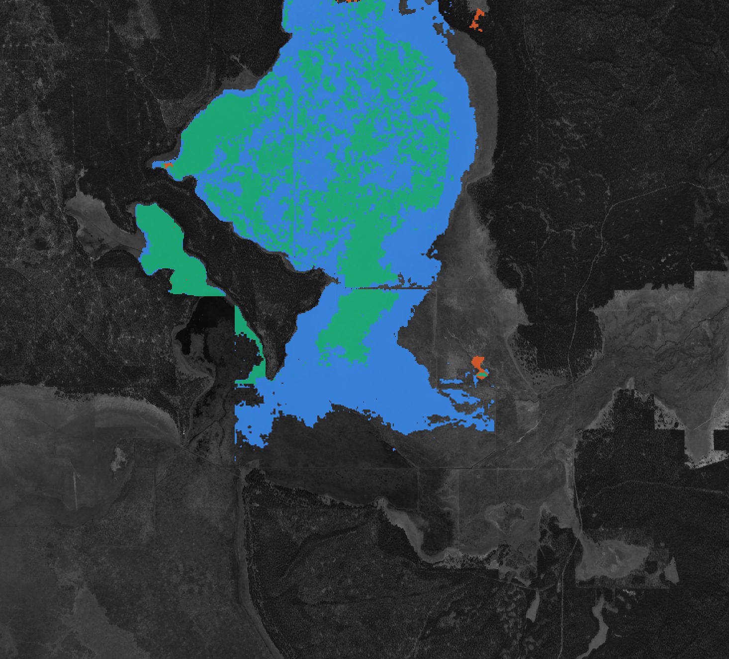
The map compares two mid-May images from big water years: May 12, 2023, before the breach, and May 6, 2025, after it. In the project reach, 1,644 acres were wet in 2025 that were dry in 2023. Only 16 acres went the other way. In the upper marsh, the wet area roughly doubled.
Twenty-five images, five water years
Step through every image used here, from April 2022 to October 2026. Switch between true color and false color.
From experiment to design
The RFP's preferred concept fills the Kittredge canal, plugs or blocks the other ditches, and lets the river flow through the current breach location to form new channels, bifurcations and overtopping areas. In effect the 2024 breach is a full-scale prototype, and two winters of its behavior are already on record.
H&H across the range of flows
Low base flow, high base flow, and peaks including rain-on-snow, with recurrence and timing.
A wet year and a dry year, observed
Water year 2025 (161% of median precipitation by April 1) and the 2026 snow drought bracket how the breach performs, and where it falls short.
Calibrate “to the extent possible”
The public gauges listed in the RFP have records ending between 2005 and 2021.
Independent extent targets
A 2022–2026 wet-extent series extends the approach of USGS SIR 2024-5033 (1985–2021). It pairs with the Tribes' UAV imagery under snow, shallow wells, refuge loggers, and the 2024 topobathy lidar.
Braided flow, slower velocities, higher water surfaces
Channel geometry and structures that spread water and hold it on the marsh.
Channels the water already chose
The relic paths the water reoccupied in winter 2024–25 are candidate alignments and a check on the model.
Identify adverse effects
Effects on adjacent landowners and infrastructure, refined over multiple model runs.
Observed footprints as a first check
Mapped wet extents show where breach-fed water went, and did not go, before any model is built.
60% design for permitting by January 2028
Construction in the 2029 dry season.
Keep watching
Each clear season through design adds another data point at no field cost.
In the room in 2024, at the table now
Trust between the Klamath Tribes, the Service and Ducks Unlimited will carry this project. Two members of our team helped shape the experiment that the design now builds on.
Senior fluvial geomorphologist. Workshop participant who led the discussion that developed the implementable alternative behind the breach.
Fluvial geomorphologist and Stage-0 design expert. Took part in the October 2024 workshop.
Roles as proposed in the draft team organization, October 21, 2026.
How these numbers were made
Wet area comes from Sentinel-2 Level-2A surface reflectance at 20 m. A pixel counts as wet when shortwave-infrared (band 11) reflectance is below 0.06, after removing the processing-baseline offset. Pixels flagged as cloud, cloud shadow, or snow in the scene classification layer are excluded. On these dates the histogram is clearly bimodal, with wet ground near 0.01–0.03 and dry ground and forest above 0.10. The method detects open water and saturated ground. It can miss water under dense summer vegetation, and it has not been checked against field data. Zones: project reach, 4,360 acres (−121.662 to −121.598° E, 42.9505 to 42.981° N); upper marsh, 12,018 acres (−121.70 to −121.60° E, 42.981 to 43.035° N).
- Contains modified Copernicus Sentinel data, 2022–2026, accessed through Microsoft Planetary Computer.
- USDA NRCS SNOTEL: Silver Creek (756), Taylor Butte (810), Chemult Alternate (395). April 1 snow water equivalent and water-year precipitation, compared with daily medians.
- Ducks Unlimited, RFP US-OR-303-103, Hydrologic and Hydraulic Study and Design of Channel Improvements, including Attachments 2 and 3.
- J. Vradenburg, USFWS, email updates to workshop participants: Oct 31 and Nov 13, 2024; Dec 13, 2024; Feb 28, 2025. Photos and compliance maps courtesy of the Klamath Basin NWR Complex.
- Kennedy, J.J., Johnson, H.M., and Gingerich, S.B., 2024, Assessment of long-term changes in surface-water extent within Klamath Marsh, 1985–2021: USGS SIR 2024-5033.
- Roads and waterways © OpenStreetMap contributors (ODbL). Section lines: BLM PLSS CadNSDI.
Draft notes for the proposal team
- Quotes, photos and maps from the refuge are used with attribution. Confirm permission with John Vradenburg (USFWS) before sharing outside the team.
- Add the Klamath Tribes' perspective in their own words after Dave's briefing, and offer Tribal staff a review.
- Confirm Colin Thorne's specific contribution to the breach design. The email record shows participation only.
- Ask the refuge whether the breach was adjusted or managed in water year 2026, or whether the low spring wetting reflects snow drought alone.
- The Rock Island diversion and supply channel are not mapped; the breach point and Ball Dam are approximate.
- If DU reviewers need a public link, confirm this page's sharing settings or move it to ArcGIS StoryMaps. All imagery and data can be exported.